An interesting idea would be a democracy where your voting right is proportional to your expected remaining years to live. This would give more power to younger generations that are the ones that are going to be the most impacted by the decisions.
I've got a notification stating that in the next update the device (a working scanner) will stop being supported, probably because of the lack of ARM driver.
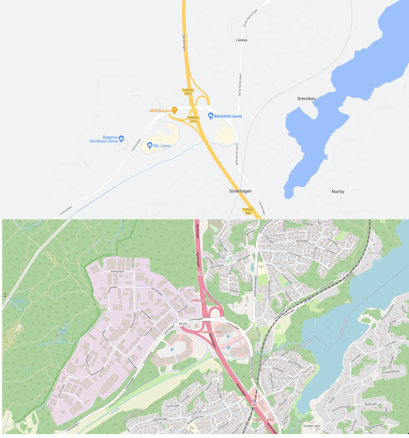
The quality of the maps is getting better, much more useful and detailed than Google Maps. I find it much easier to locate myself on Organic Maps than Google Maps. For example parks are only a green blob on Google Maps, while benches, walking paths, drinking water points, toilets and other landmarks and buildings are visible on Organic Maps. I find that adding transit lines or cycling routes as an overlay is also a great feature. Even the search feature is getting broken on Google Maps, when making a search, it would show up advertised results (in red squares instead of red circles) and when browsing the map there are more advertised useless places surrounded by an almost empty map. The only advantage of Google Map is to find the best way from point A to point B and places reviews.
That's OSM Carto[1] on the bottom, the default renderer/style on osm.org, but there are many alternative ones too. For example, Maptiler[2] has a bunch of cleaner styles, closer to Google's, yet with greater detail. Here is a basic one used my OSMApp[3] for that place as well: https://i.ibb.co/7dD05Ldp/Captura-de-ecr-20260706-092411.png
In some places it always was better (it's OpenStreetMap data) e.g. in the Puna de Atacama desert in Argentina/Chile, Google Maps is years behind in therms of map precision. Lots of roads are missing from Google Maps. Plus, OrganicMaps working totally offline, it's perfect for such a place where the only Internet would be by satellite.
But it really depends not only on the presentation theme but also on the data set itself and that varies by region. I'm sure that there are still places where the sources Google is buying are better than whatever is on OSM, just like there are regions where OSM is just so much more detailed than everybody else. And yet others, where OSM is generously fed by an entity that also supplies Google and all the others because they are not doing it for the map, they are doing it for the place.
The great thing about OSM is that if an area someone cares about is sparsely covered, that's a self-solving problem. There are parts of the world with great detail in OSM only because I happen to care about them.
On my Pixel phone I always leave enable the "Top Shot" setting, it saves a short low resolution video clip in the XMP/RDF metadata of the JPEG file. It saves motions that are not visible on a still image adding valuable information. iPhones and Samsungs have similar settings.
Live Photos are what iPhones call it and I love them. I made an app to turn them into GIFs, I often make wigglegram GIFs out of them. "Giffer" on the App Store[0] if any readers are interested.
This is a weird application for such sensors. The train may be used as a test platform. DARPA launched a program to develop quantum sensors that are reliable outside the lab recently [1].
How does it differ from cameras used in capsule endoscopy [1]? The technology has been available for 25 years and is widely used (4 millions units sold in 2024).
I would say that you are persistent if you keep getting rejected but keep improving but using feedback and you would be stubborn if you don't change a thing while keeping being rejected.
Most likely, a glorified black monolith brick like Ive loves them, without any display or a really small oled. Or a stick, like a pen you can clip on your pocket, but the battery may be an issue.



reply